
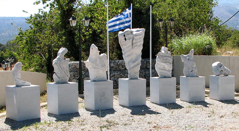
Description
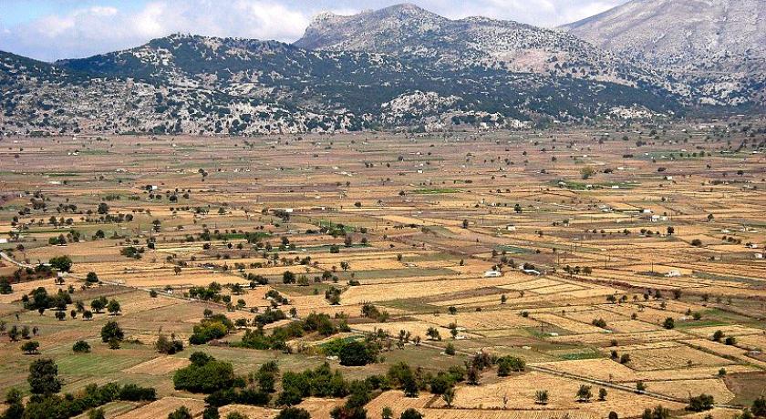
The Lasithi Plateau (Greek: Οροπέδιο Λασιθίου, Oropedio Lasithiou), sometimes spelt Lassithi Plateau is a high endorheic plateau, located in the Lasithi regional unit in eastern Crete, Greece. Since the 1997 Kapodistrias reform, it is a municipality whose seat is its largest village, Tzermiado. The municipality has an area of 129.976 km2 (50.184 sq mi).
Geography
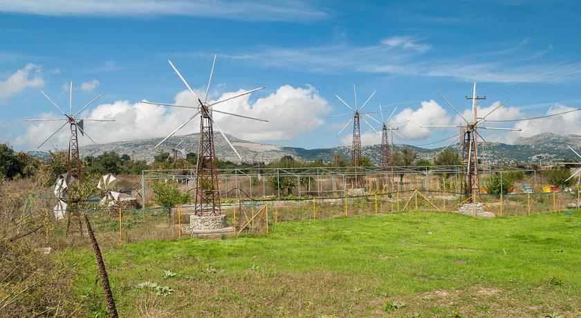
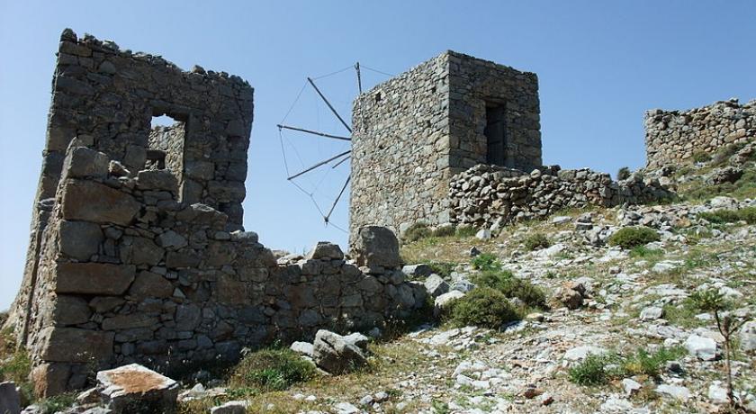
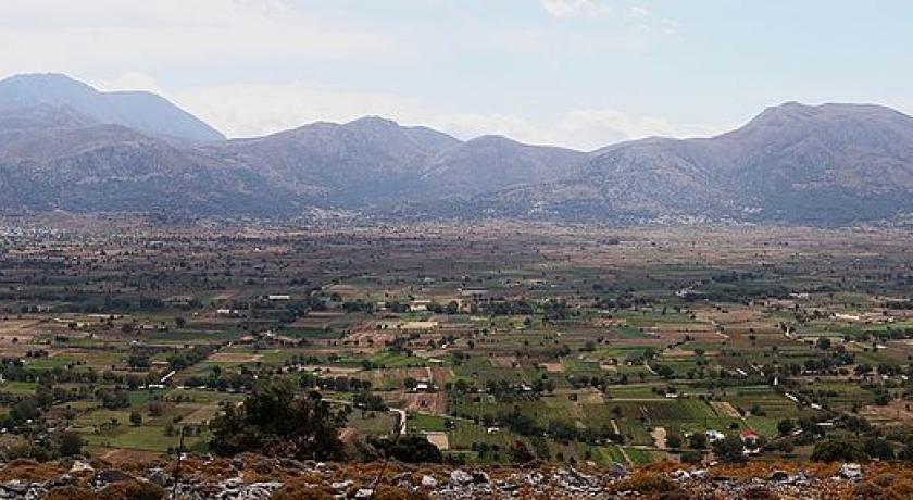
The Lasithi Plateau stretches 11 km (6.8 mi) in the E-W direction and 6 km (3.7 mi) in the N-S direction. It is approximately 70 km (43 mi) east from Heraklion and lies at an average altitude of 840 m (2,760 ft). Winters can be harsh and snow on the plain and surrounding mountains can persist until mid-spring. The plateau is famous for its white-sailed windmills, (more accurately, wind-pumps), made to a local design, that have been used for two centuries to irrigate the land. Despite their being around 10,000, in the past, most of them have been abandoned nowadays in favour of modern diesel and electric pumps. Because the water table is close to the surface of the ground, all burials in cemeteries are above ground, in a stone mausoleum, or a stone box with decorations. This is because the plateau is endorheic, and there is impermeable rock just below the surface of the ground.
History
The fertile soil of the plateau, due to alluvial run-off from melting snow, has attracted inhabitants since Neolithic times (6000 BC). Minoans and Dorians followed and the plateau has been continuously inhabited since then, except a period that started in 1293 and lasted for over two centuries during the Venetian occupation of Crete. During that time and due to frequent rebellions and strong resistance, villages were demolished, cultivation prohibited, and natives were forced to leave and forbidden to return under a penalty of death. A Venetian manuscript of the thirteenth century describes the troublesome plateau of Lasithi as spina nel cuore (di Venezia) - a thorn in the heart of Venice. Later, in the early 15th century, Venetian rulers allowed refugees from the Greek mainland (eastern Peloponnese) to settle in the plain and cultivate the land again. To ensure good crops, Venetians designed a large system of drainage ditches (linies, Greek: λίνιες) that were constructed between 1514 - 1560 and are still in use. The ditches transfer the water to Honos (Greek: Χώνος), a sinkhole in the west edge of the plateau, that feeds the river Aposelemis.
During the Greek War of Independence in January 1823, Hassan Pasha led an army of Ottoman and Egyptian forces sent by Muhammad Ali that seized the plateau killing most residents who had not fled to the mountains. In May 1867 during the great Cretan revolt, Ottoman and Egyptian forces under the command of Pashas Omar and Ismail Selim marched towards the Lasithi plateau. Their aim was to strike a decisive blow on the revolutionaries who used it as their hideout. After fierce fighting, the outnumbered rebels were defeated and forced to retreat to the slopes of Dikti. Between 21 and 29 of May, many village dwellers were slaughtered or taken slaves, their homes were set ablaze after being looted and livestock and crops were destroyed. The monastery of Kroustalenia that was the seat of the revolutionary committee was also demolished.
During the Axis occupation of Greece in 1941–1944, the peaks surrounding the plateau were used as hideouts by local resistance fighters.
Archaeological sites
There are several caves of archaeological interest in the plateau and surrounding mountains. Diktaion Andron (Greek: Δικταίον Άντρον, also Diktaean / Diktaian Cave) near the village of Psychro (Greek: Ψυχρό) is reputedly the birthplace of Zeus according to Greek Mythology. Zeus is also said to have used Diktaion Andron as his hiding place after abducting Europa. The archeological site of Karfi, believed to be the last outpost of the Minoan civilization is located in the mountains immediately north of the plateau.
Economy
Permanent residents derive most of their income from agriculture and animal farming, a smaller number from tourism.
Population genetics studies
Because of its isolated nature, the Lasithi plateau has attracted the attention of population geneticists. A 2007 Y-DNA study showed that Y-DNA samples from the Lasithi plateau differed significantly from those of lowland Crete, and may be indicative of it having served as a refugium of the Minoan civilization. A 2013 mtDNA study of bone samples from a Minoan ossuary in the Lasithi Plateau, dated to 4,400-3,700 years ago, showed that Minoan samples were closest to samples drawn from the modern population of the plateau, as well as other Greek, western and northern European samples, while being distant from North African and Egyptian samples. According to the authors, these results are consistent with the hypothesis the plateau served as a Minoan refugium, and that the current inhabitants of the plateau carry the maternal signature of the Minoan population.
Address
Lasithi
Greece
Lat: 35.149791718 - Lng: 25.497047424

