
Description
M’bour (M'Bour or Mbour) is a town in Western Senegal, located on the small coast (Petite-Côte), about 80 km south of Dakar and 5 km from the seaside resort town of Saly.
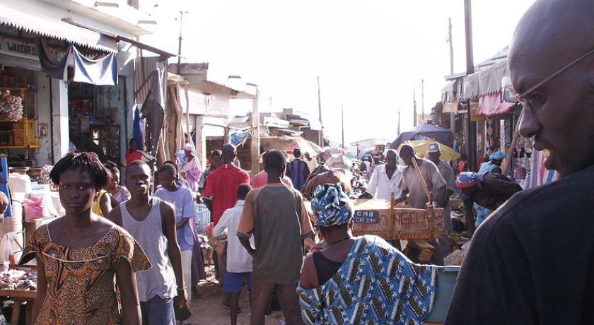
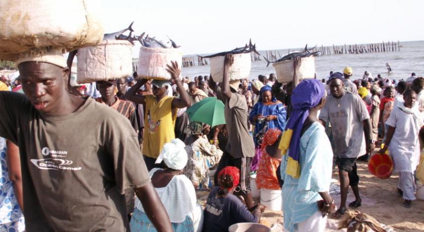
M’bour is a small town with a high population level with more than 160,000 inhabitants. Initially, with a small fishing port, M’bour became one of the most important fishing port in Senegal. There are hundreds of canoes that commerce’s daily, and this brings life to this city.
Tourists remembers above all this amazing vision of the return of the fishermen, this inevitable wild activity! Around 5 p.m., the canoes returned to port; After unloading, the fish is freshly sold or dried.
The wagon freezers waits in the wharf, they move inland towards the airport so that the fishes will arrive in Rungis (Paris) at dawn. At sunset, when the boats sails into the harbour, you will discover an overflowing fishing nets with lots of fishes, it is an exceptional show to see this crowd all working. A difficult, rough labour but always carried out in good faith…
The proximity of Saly also developed M’bour in the area of tourism. Hotels, restaurants, bars, vacation houses does not count any more! Important addresses are always mentioned while passing! At the administrative level also, M’bour became an important city. It is also the“dormitory town” of the majority of the Senegaleses who work in the tourism sector.
History
The mbour community accepts the thesis which supports the first occupation by the sérère. According to the common version, at the beginning of the 19th century, Sine and Cayor were torn by wars. Certain families had to flee, one of it arrived at Mbour and was fixed at the current site of the prefecture of the city.
Two versions dispute the origin of the name of the city. The first evokes the expression sérère“in Mbouara Adett” which means literally: “They left and they went”. The second allots the foundation of the village of Mbour to a certain Mbour Faye which would have given it his name.
Thereafter, the colonists arrived in great number, to settle along the littoral and made of Nianing their stronghold. Later, the sleeping sickness pushed them to move towards Mbour to transfer the residence of the commander in chief of the subdivision; the population joined progressively.
From these we could testify that the Sérères, followed by Socés, are the first occupants of the city. Today, the city has become a cosmopolite with the arrival of other ethnic (Wolof, Al pulaar, Maure….) foreigners from the sub-region, and also Libano-syrians, Causasians, Asians etc.
The lifting of Mbour into a municipal gave boost to its growth. The mixed municipal of Mbour was created on the 4th of December, 1926 and the decree n° GB 152 of January 12th, 1927 of the general governor of the colonies who named the first Members of the municipal Commission, who were all French citizens.
Around 1930, the new municipal of Mbour was made up of two villages: white on one side, and natives on the other. It is thereafter, with the progressive settlement that the districts were formed with chiefs as leaders.
The expansion of the city was done in four stages:
before the colonial period;
from 1922to 1945;
from 1946 to 1976;
from 1977 to our days.
The first stage of this space evolution goes from the first installations of the populations on arrival of the French in 1922. During this period, the occupation of the site was limited primarily to the littoral, with the establishing localities of the Sérères, Socés and Lébous immigrants . This stage is primarily characterized by a low level of occupation of space.
The second phase relates to the period from 1922 to 1945. It was marked by operations of public cleansing of public structures, consecutive with the colonial presence and which did deep;y upset the urban structure of Mbour. Thus part of the Sérères community that fleed the cleansing formed the present district known as Mbour-sérère II, located 2 km east of the original site. The same led to the creation of the districts Thiocé-west and Santessou, respectively in 1922 and 1936, following the displacement of the Mandincas from escale.This period also witnessed the settlement of the districts Mbour Toucouleur and Tefess by the toucouleurs and the lébous attracted by the economic potentialities of the incipient city.
During the third phase corresponding to the period 1946 to 1976, the installations continued and the urban fabric was more packed. This phase generated the birth of the districts DarouSalam and Mbour Maure east of the city. It is also for this period that the city knew a fast extension and glorious starting from the original core formed from the escale district.
The fourth and last stage of 1977 to our days, are marked by a continuation of the urban extension. The presence of the ocean limits any possibility of extension towards the West.Thus the central areas and closer urban towns like Thiocé-East, Thiocé-West, Tefess and November 11 knew a strong spatial growth. It is in this context that other districts like Diamaguene I, Diamaguene II, Northern waterTower and Southern water Tower, which constitutes the respective prolongations of these various districts. For this period, the surface of the city knew an exponential evolution, passing from 522.9 ha to 1978, 845.5 ha in 1989 from 1725 ha to 1999.
Another layer had to be grafted on these districts starting from 2000 with the allotments of the districts: Médine, Médine Extension, Large-Mbour, Liberty I, Liberty II, Gouye Mouride, Terrou Mbaling, Baye Deuk. This spacial growth, which took place mainly in the land of the Rural Community of Malicounda, caused real tensions between the two administrative entities.
Geography
The closest localities are Saly Niakhniakhal, Saly-Portudal, Malikounda Sas, Falokh, Sintiou Mbadane, Nianing and Warang.
Dakar, the capital, is 83 km.
Economic activities
The city developed around a titanium mine. In addition to the mining extraction, the main activities are fishing and tourism.
M’bour is to the second largest port in Senegal, after Dakar. It exports mainly to neighbouring countries and the European Union.
It is also an important tourist center, appreciated for its sandy beaches and the possibility of large scale fishing, and for the experimental ecological Reserve of M’bour, a site protected since 1987.
Culture
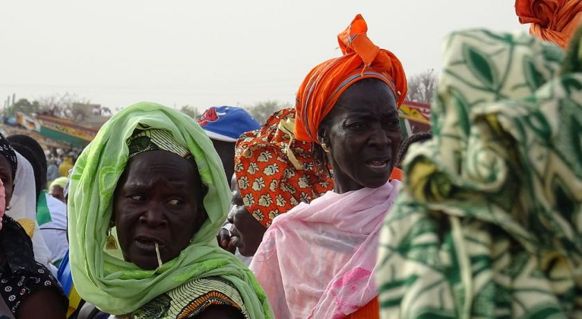
Kankourang is an event which celebrates circumcision within the mandingue community of Mbour. The coming out of the“Kankourang”, a mythical character covered with red barks of a tree called fara, crosses the streets to protect the young circumcised during their initiation and always astonishes the population and the tourists. The stay in the“sacred wood” of circumcised lasts approximately one month and the Kankourang appears during four successive sundays (and almost every night), preferably during summer holidays, in September.
source
Address
M'bour
Senegal
Lat: 14.422842026 - Lng: -16.965375900

